Welcome to the Bluestack Way audio guide
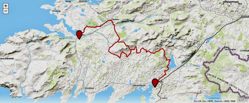
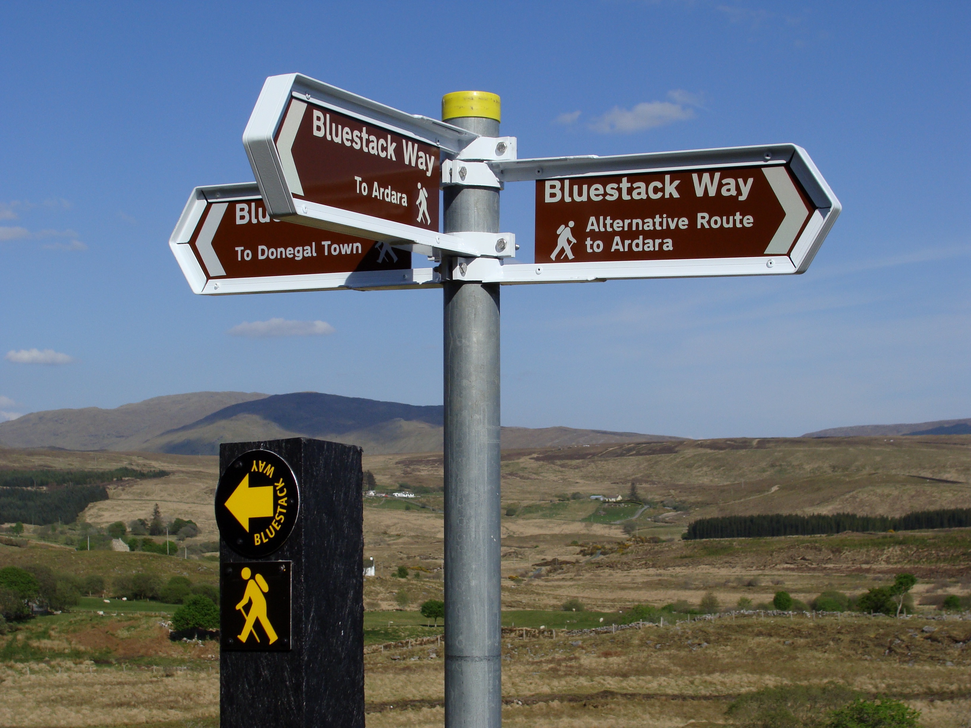
The Bluestack Way is a 51km national waymarked way through often remote areas of County Donegal. With this guide, enjoy spectacular views and great stories as you traverse the Bluestack Mountains. The route connects Donegal Town with the town of Ardara on the west coast, taking in the town of Glenties. Look out for directional yellow arrows and yellow ‘walking man’ signs familiar to walkers worldwide. Each day offers a wealth of stunning scenery. With this guide, each of those days comes with a range of stories to complement your surroundings. Firstly, the trail passes the Eske river to get to Lough Eske. Secondly, it climbs to the secluded Eglish valley and winds its way along the Eanymore river to Drimarone.
The hills are alive
Thirdly, by the foothills of the Bluestacks, you’ll reach an area called Disert, an ancient holy well and graveyard. The route then crosses the Bluestacks range over rough and remote high moorland terrain between Binbane and Cloghmeen Hill. The descent follows along the Owenroe river to reach an old bog road bringing you to deepest Doobin, the remotest part of the Way.
From there, you”ll cross an isolated bogland at Meenawannia to reach Glenties. Finally, it’s an easy half-day walk following the Owenea river to the town of Ardara. These places may sound like a succession of curious names right now. However, rest assured, you’ll know them well by journey’s end. Above all, they’ll become places you dream of returning to some sunny day.

Bluestack Way route
Getting your bearings
The Bluestack Way starts on The Diamond in Donegal Town. Our guide is primarily designed to tell you about the lore of the area. We will help guide you along the route with our maps, but please be armed with OS Maps 10 and 11. These are available from nearby Timony’s Spar Shop & Newsagent just off the Diamond. Needless to say, bring a compass, a fully-charged mobile phone, good quality footwear, raingear, water and snacks. The map for the Bluestack Way (from the Bluestack Environmental Group) is available from The Four Masters Bookshop on the Diamond. Use of this guide is subject to being bound by our Licence.
To get the most out of this trek, some advance preparation is advisable. Make sure you enjoy a night’s fun in Donegal Town itself the night before your walk begins in earnest. We recommend the Harbour Restaurant for good food and The Reel Inn for good trad music. Find out more at TripAdvisor for the town.
Handy links for each part
This page contains an overview of the complete Way. Below we have links to the various other parts of the Way. This is much easier than scrolling endlessly on just one page! Simply click on the colour-coded section below you’d like to be taken to. There are a lot of people to thank and for ease of reference, we have placed that information, as well as Walking Tips, on these separate links below.
Parking can be done by the Tourist Office down by the quay. We suggest you ask them about leaving a car for a few days without incurring numerous parking tickets. Donegal Town has extensive Bus Eireann bus services, but Ardara’s bus services will take some planning! Our walking tips section below is comprehensive. One point bears repeating here: please do not bring dogs or pets on any section of the Bluestack Way, which crosses private farmland.
Technical Details
Trail Start: The Diamond, Donegal Town
Trail Finish: The Diamond, Ardara
Length: 65km (incl 14km alternative route)
Total Climb: 1230m
Time to complete: 3-4 days
Type: National Waymarked Way
Format: Linear
Waymarking: Yellow arrows and walking man
Grid Ref: G 929 784
Grid ref: G 736 908
Maps: OSI Discovery Series Sheets 10 and 11
Top Tips
Top Tips
There’s quite a lot of audio which is presented in a linear form as you walk the route. We’d suggest that you familiarize yourself with the material on each section in advance. Needless to say, it is best enjoyed on good earphones and with your mobile phone’s battery fully charged! If your podcast server allows you to download, do so in a WiFi zone before travelling the next section.
Homework needed!
This guide is primarily intended as a means of enjoying the lore and history of the area. While it follows the route of the Way, it should be used as a supplement to, not a replacement for, proper map and compass reading. Full advance preparation should be made of the route with Ordnance Survey maps that should be taken with you together with proper equipment, apparel and sustenance. The route is well-marked with the Yellow Man icons for waymarked ways in Ireland. For ease, we do give directions in green boxes along the way at key junctures.
Recommended Professional Guides
Fancy getting the most out of the Way with some proper professional guidance along the route? We can recommend the following professional guides for the following parts of the Bluestack Way: –
- Patsy McNulty +353(0)877941234 (Parts One and Two)
- Brendan Proctor +353(0)863373031(Parts Three/Three Alternative)
- Bradas McDyer +353(0)863530537 (Part Four)
Left to Right with the three mountain musketeers: Bradas ready for the river, Patsy rocking out in Disert and Brendan looking yonder!

How best to use this guide on the move
You can enjoy all of the material on your favourite podcast platform from our Audio Archive on Audioboom. Depending on which stage of the Way you are on, just look out for the relevant lettering – BSW1 is the first section to Lough Eske and BSW4 is the fourth section to Ardara. Each episode will also have number in a linear fashion so BSW1 1. The Diamond is the first one to look out for and BSW1 18. The Friary is the last episode from that section.
Prior to commencing this epic journey, please download the audio material in a WiFi zone so you can enjoy the audio even if you are in the back end of Meenawilderg or Doobin! In addition, we have a created a dedicated Spotify playlist for The Bluestack Way having all the same great material all in one compact guide. Look out for our Donegal’s Hallowed Sites playlist on Spotify if you enjoyed this guide.
And finally…
- This page and each of its associated guides is accurate as of May 2022. Please inform us of any changes or improvements that can be made to this guide in the future: info@racontour.com
- If you enjoyed this free guide, please share it on social media and if feeling extra generous, write a review in Tripadvisor. Thanks!
- Have a great time – we wish you safe walking, good weather and an abundance of happy memories.
John Ward, Racontour Productions, May 2012 – May 2022


